
Lexington Neighbor Records by Block
A Lexington block has several public layers, and each answers a different question. The parcel map defines lots and gives a parcel number. PVA records can show assessed ownership. Deeds document recorded transfers. MapIt supplies civic geography and an association contact. Historical directories preserve dated street entries. None is an official list of every person now living nearby.
| Source | What It Shows About a Block | Access |
|---|---|---|
| LFUCG parcel GIS | Parcel polygons, PVANUM, address fields, acreage, class, condo and adjacent geometry | Public REST query and map; no occupant list |
| Fayette PVA/QPublic | Owner, assessment, tax, and sale fields as displayed | Public search; owner is not occupant |
| MapIt | ZIP, precinct, council district, watershed, association, waste day, and parks | Address-based civic layers |
| Neighborhood association directory | Public association name and contact | More than 250 groups; no public member roster |
| Historical directories and maps | Dated street names, firms, institutions, printed residents, and building use | Edition-specific, not current residence proof |
Begin with geometry when the question is “who is next door.” Street numbers can be misleading because alleys, rear lots, condominium units, rights-of-way, and shared tracts interrupt a neat numeric sequence. Once the true adjacent parcels are known, their public records can be checked one at a time. Keep “recorded owner” as the label unless another official source supports a different fact.
Match Lexington Parcel Identities
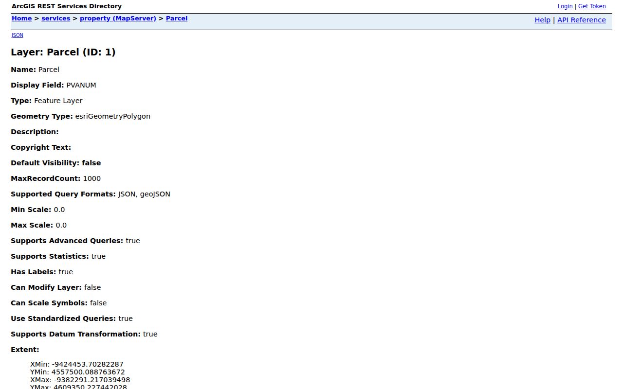
The LFUCG parcel layer returns PVANUM, number, direction, street name, street type, address, unit, acreage, class, condominium marker, cabinet or slide reference, and date entered. Save PVANUM first. It is the strongest cross-system key for checking the same land in GIS, PVA, and deed research.
Several address fields may coexist. A situs address is the physical 911 location. A PVA mailing address is where tax or assessment mail goes. The deed's legal description identifies the land and can use a lot, plat, or boundary description. A voter residence is governed by election rules. Occupancy is a separate fact that these property systems generally do not establish.
The public parcel schema can be viewed at the official GIS service. Its captured field view appears below.
Map Lexington's Adjacent Parcels
Select the target polygon, not just its map pin. Then inspect polygons that share a boundary. A geometry or distance query can widen the search when a road, creek, lane, or common tract lies between taxable parcels. This approach fits Lexington neighbors on irregular lots, large acreage, and condominium sites much better than assuming the next street number is next door.
- Find the address in MapIt or the parcel layer and save its PVANUM and boundary.
- Select each boundary-sharing parcel. Use a distance query when a right-of-way or common area breaks contact.
- Carry every adjacent PVANUM into the PVA search. Compare situs, mailing, acreage, class, and condo fields.
- Use the Fayette deed index only when a transfer, easement, restriction, or plat would clarify the block.
A trust, estate, corporation, subdivision, or condominium may require grantor and grantee searches in both directions. Shared drives, rear lots, and older lot lines can also appear in plats or Sanborn sheets. For a whole named road rather than the immediate radius, use the Lexington street directory workflow.
Insider tip. Record PVANUM in GIS first, then carry that number into PVA and deed work so similar addresses do not merge.
Place Lexington Neighbors Civically
The LFUCG MapIt viewer translates one address into several civic geographies: ZIP, voting precinct, council district and member, state legislative districts, watershed, neighborhood association, waste day, and nearest park. These boundaries can overlap in ways that do not follow a subdivision name or postal label.
Use each layer for its stated role. A council district identifies representation. A watershed connects the block with drainage geography. A ZIP describes mail delivery, not a neighborhood. An association boundary identifies a civic group, not everyone who belongs to it. Capturing the address and access date helps because parcel and civic overlays may change on different schedules.
Note: Two homes can share a street and ZIP while falling in different association, precinct, watershed, or preservation layers.
Find Lexington Neighborhood Contacts
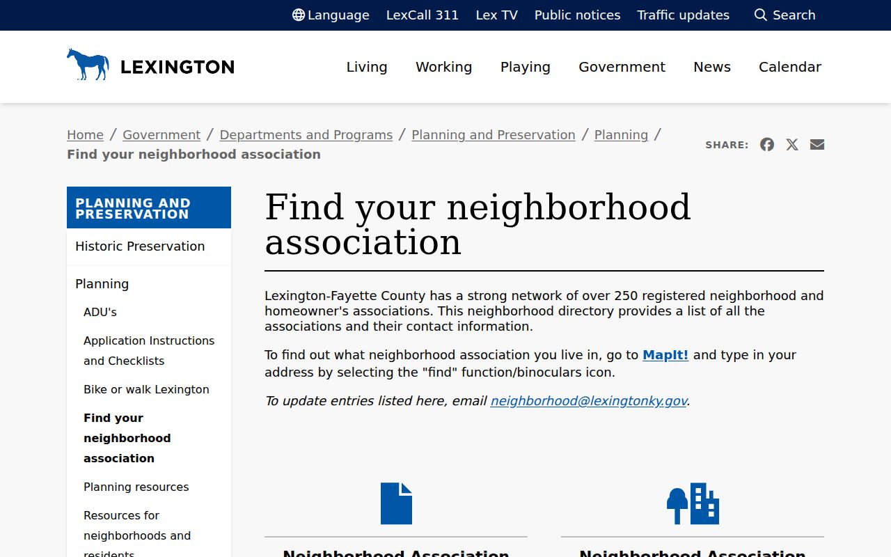
Lexington reports more than 250 registered neighborhood and homeowner associations. The city neighborhood directory is a public civic contact network. Use MapIt to identify the group associated with an address, then use the directory for its published contact information.
MapIt
Start with an address to identify the neighborhood association layer and other civic boundaries.
Association Directory
Confirm the group's public name and contact. The listing does not disclose household membership.
Planning
Ask city planning staff about the public association directory or mapped boundary when a result is unclear.
The distinction matters. A contact person is not an official representative of every neighbor, and the city directory is not a resident roster. Stop at the public contact unless the association itself publishes a roster and authorizes access.
The successful city capture below comes from the official neighborhood association directory.
Lexington Block Voter Limits
The Kentucky Voter Information Center is an individual lookup. It requires legal first name, last name, date of birth, and optionally the last four Social Security digits. It reports current registration, polling, and absentee status. It does not accept an arbitrary Lexington block and return all voters.
KRS 116.095 allows inspection and copying of existing voter-registration records with Social Security numbers redacted. Bulk data uses the SBE-84 request process and is restricted to qualifying users and allowed geographic scopes, such as county or precinct. It is not an unrestricted neighbor list. Kentucky Safe at Home and other confidentiality rules can also make a public block view incomplete by design.
When a lawful request is needed, use the State Board of Elections form and the documented state channels. Do not try to infer protected addresses by combining gaps across sources.
See Past Lexington Neighbors
Historical street sections can show who was printed near an address at a particular date. Lexington sources include the 1906–07 Cross Directory, 1940 Cross Directory, 1942 Street Directory and Map, 1944 phone directory, and 1956 Street Directory. Rural Fayette may require the 1912 or 1940 rural directory or the 1971 farm directory.
Read each entry with the volume's abbreviation key and copy the exact spelling, number, direction, name, occupation or firm, and year. An entry can represent a subscriber, business, owner, boarder, or institutional contact. It is not a continuous census. E911 address-change records, current GIS, deeds, and Sanborn maps can bridge an old number to today's parcel.
Historic Preservation adds a different layer. Lexington has fifteen local districts and two landmarks under Board of Architectural Review jurisdiction, while National Register listings cover more districts and sites. A preservation file may explain the physical history of nearby buildings without naming current occupants.
Compare Lexington Neighbor Tools
Official sources and commercial neighbor-search products have different strengths. Official records identify their custodian, field meanings, and record dates. Commercial products may combine old material without showing whether a name came from ownership, a directory, or another source.
| Route | Useful For | Main Limit |
|---|---|---|
| Official GIS, PVA, deeds, and civic directories | Parcel boundaries, recorded owners, instruments, districts, public group contacts | Separate systems; no complete occupant roster |
| Commercial neighbor-search category | Possible leads gathered from mixed sources | May be stale, mismatched, costly, or unclear about provenance |
| In-person and request channels | Specific copies, older books, existing logs, staff help locating a record | Requires a focused request; staff need not create a new list |
The documented fallback chain is MapIt and GIS, PVA, Fayette Clerk, Planning or Historic Preservation, the Kentucky Room, KDLA or KHS, and a focused open-record request for an existing record. Phone, mail, email, forms, and in-person access remain important when a portal fails.
Protect Privacy of Lexington Neighbors
Property records do not establish renters or all household members. Utility, delivery, and private membership data are not public neighbor directories. Juvenile, sealed, expunged, and sensitive records have their own limits. Kentucky Safe at Home provides a substitute address and mail forwarding for qualifying survivors, so an apparent gap must never become a prompt to reverse a protected location.
Names also need context. A deed identifies a recorded party to an instrument. PVA identifies an assessed owner as of its record date. A directory prints an entry from one edition. A specialized safety or court record must not become a character label for a whole household or block. Verify facts with the custodian and keep personal conclusions out of the record.
Lexington's neighborhood directory lists more than 250 registered associations, yet it does not disclose a membership roster. Public contact details identify a civic group, not every person living inside its mapped area. MapIt can return the association linked to an address, while Planning staff and district pages provide the proper route for current public contacts.
Lawful use. Use Lexington neighbor records for civic awareness, reconnection, or personal safety. Never watch, intimidate, expose, or harass another person.