
Walk a Lexington Street by Address
A sound Lexington street search moves from geography to names. Start by standardizing the street number, direction, name, type, and unit. The LFUCG parcel layer returns those parts separately, so an apartment or directional prefix is less likely to be lost. Its parcel number, called PVANUM, is the best handoff to the Fayette County Property Valuation Administrator and the deed index. Ownership, a voter registration match, and a printed directory entry are different kinds of evidence. Date each result and keep its source.
- Enter the current address in MapIt or the public parcel layer. Copy the normalized address and PVANUM.
- Open QPublic and compare the parcel, assessment, and owner fields displayed there. Do not treat a mailing address as an occupant list.
- Search the Fayette deed portal by the owner and address. Record the instrument number, book and page, date, type, and legal description.
- Use the Kentucky Voter Information Center only for one voter’s own current registration and polling details. It does not offer a public street roster.
- For an earlier date, check the nearest Lexington Cross, street, phone, rural, or farm directory edition and cite its page.
This sequence makes the Lexington street directory useful for property curiosity, family history, estate research, and checking a seller’s claim. A missing result is a prompt to try an old street name, a rural directory, or the in-person archive, not permission to guess who occupies the site.
Write down the search date at every stop. The deed portal carries a live verified-through timestamp, while GIS, PVA, permit, and directory records follow their own update schedules. Two screens viewed on the same day may describe different effective dates. A compact worksheet can keep address form, PVANUM, named party, record type, record date, custodian, and image or page citation in separate columns. That practice also makes contradictions easy to spot. If the deed and PVA show different names, check the transfer date and January 1 assessment rule before deciding that either system is wrong.
Lexington Street Fields That Matter
The LFUCG parcel service exposes both address parts and parcel geometry. It accepts public queries and can return JSON or geoJSON, with a maximum of 1,000 records per response. The attribute list is more dependable than a number-only scan of a block because it separates direction, street type, unit, condominium marker, acreage, and the parcel identifier.
| Lexington control | Format | How it helps by street |
|---|---|---|
| PVANUM | Eight-character string | Links GIS geography to PVA and deed research. |
| NUM1, NUM2, DIR | Street-number strings | Preserves a range and directional prefix. |
| NAME, TYPE, UNIT | Street and unit strings | Separates the named road, suffix, and unit. |
| where, geometry, distance | Query controls | Filters a named street or selects nearby polygons. |
| PVA_ACRE, CONDO, DATEENTRD | Number, text, date | Adds parcel context without identifying occupants. |
The source image shows the official parcel layer interface. Inspect the LFUCG parcel layer before using its fields.
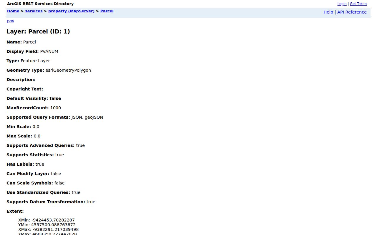
That field list provides the exact terms needed to reproduce a parcel lookup and distinguish adjoining polygons from addresses that merely look consecutive.
Bridge Lexington Parcels to PVA
The Fayette PVA QPublic search is the current assessment route. The research capture showed four quick-search text controls and an address-search option, but their full labels and the result-card schema did not render. Use only the fields visible in the live portal. The PVA says assessment condition is keyed to January 1, and a later transfer can leave the tax bill initially tied to the January 1 owner.
The PVA reports 115,158 certified real-property parcels for 2026 and about 35,000 inspections each year. That scale explains why PVANUM is a better cross-system key than a loosely typed name. The change-of-address form changes where tax mail goes. It does not change the parcel’s physical, or situs, address and does not certify who lives there.
Noncommercial data requests use the PVA information-request form. It asks for requester contact details, purpose, custom-order details, signature, and a noncommercial certification tied to the requester’s login. The certification bars sharing the login or selling, leasing, soliciting with, or otherwise using the data for profit. For a normal street-directory check, the public parcel and address tools are the narrower first choice. Ask the PVA directly when the needed existing field is not visible online.
Open the Fayette PVA property search to compare the live address and parcel controls.
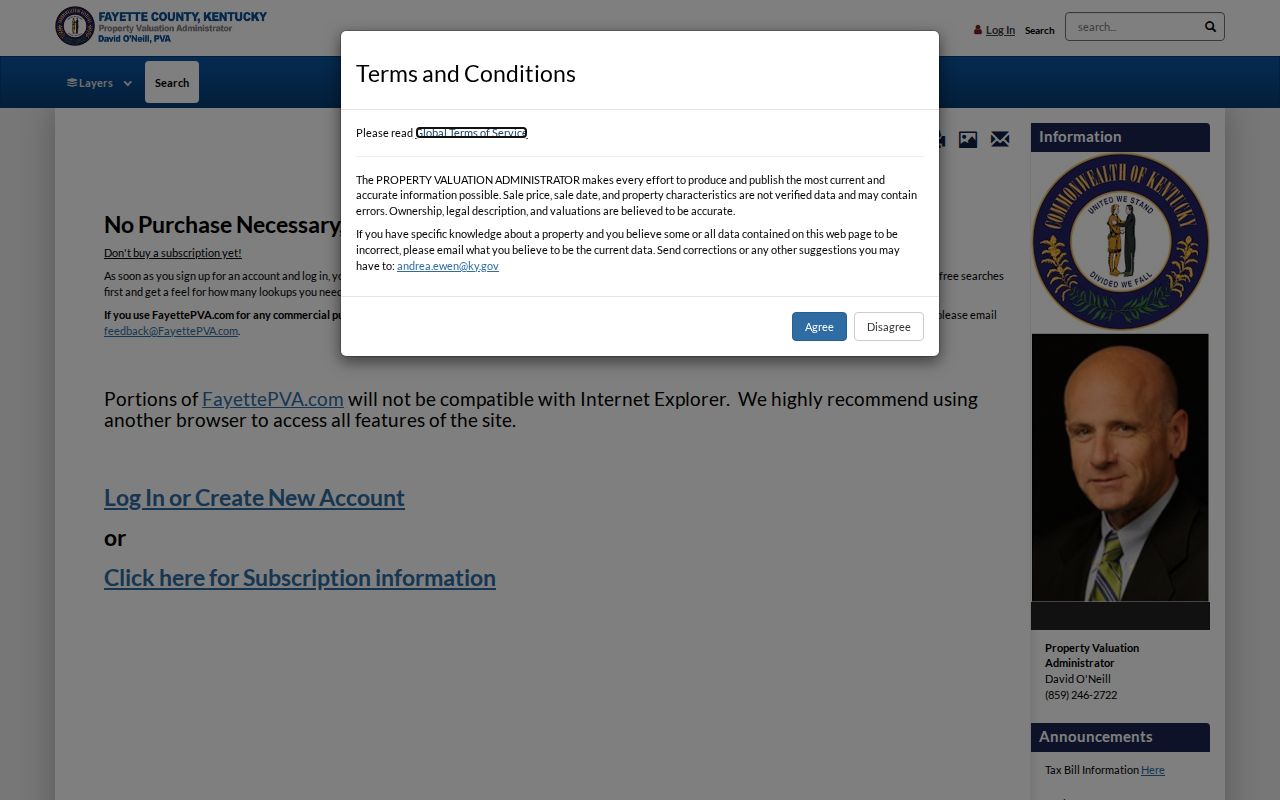
The captured search screen is a starting point, while the current result and its date remain the evidence to save.
Lexington Street Records by Source
No official Lexington roster lists every current resident by street. The useful records are address-keyed systems held by different offices. Their coverage and limits should stay visible beside every result.
| Address source | Custodian | Street evidence | How to reach it |
|---|---|---|---|
| Parcel assessment | Fayette PVA | Current parcel, assessed owner and related fields shown live | QPublic, PVA form, office or phone |
| Parcel geometry | LFUCG GIS | PVANUM, normalized address, acreage and adjoining shapes | REST layer or MapIt |
| Recorded instruments | Fayette County Clerk | Grantor, grantee, deed, mortgage, easement, plat and legal description | Portal, DAP, counter or copy request |
| Address changes | LFUCG E911 Addressing | New address, old address, resolution and resolution date | Online search, office or city records request |
| Development records | LFUCG planning and inspection offices | Planning, permit and mapped development activity | Accela, AgencyCounter, office, phone or email |
| Printed directories | Library and historical repositories | Dated names, occupations, street entries and institutions | Digital archive, Kentucky Room, KHS or KDLA |
If an online system fails, call or visit the custodian. The PVA is at 101 East Vine Street, Suite 600, and the Fayette County Clerk is at 162 East Main Street, Room 132. Clerk copies can be requested after the exact book, page, or instrument is identified.
Follow a Lexington Street Deed
The Fayette deed portal searches by party, address, book and page, instrument number, date, subdivision, lot, block, or description. Main indexed images begin in mid-1989. Older work moves to DAP books, which reach into the late 1700s by record series. Search both grantor, the person conveying an interest, and grantee, the person receiving it. Trustees, estates, companies, correction deeds, releases, and name variants can interrupt a simple chain.
A deed is only one instrument in the street record. Mortgages, releases, assignments, easements, restrictions, powers of attorney, affidavits of descent, wills, partitions, plats, and surveys can explain why a name or legal description changes. Record each cross-reference before moving backward. The clerk does not conduct title searches or genealogy work for requesters, so identify the exact document before asking for a copy.
Review the official Fayette land-record search before recording the portal’s live verified-through date.
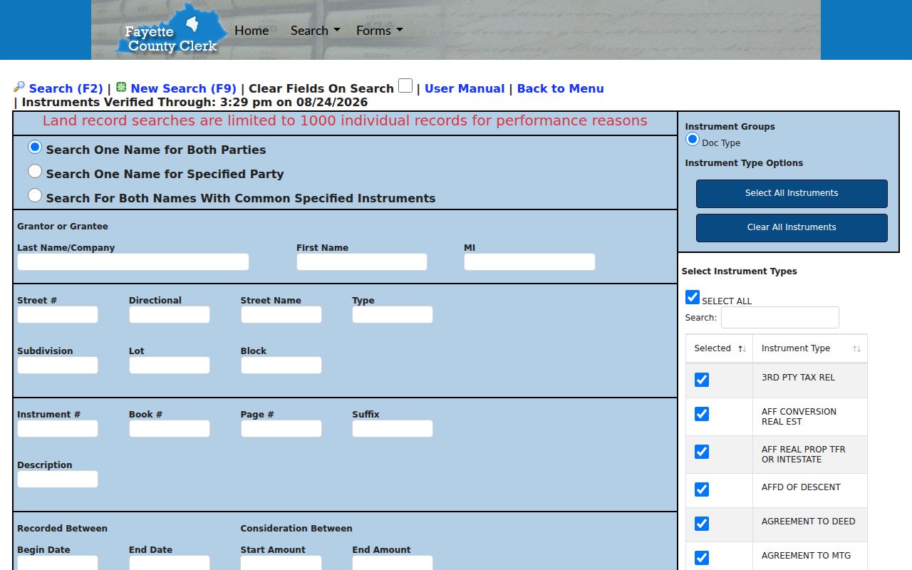
The captured portal demonstrates the current index route; it does not replace the instrument image or the older non-indexed books.
For a precise handoff to historic images, the clerk’s DAP instructions explain the page-based system.

Those instructions matter when an address trail crosses the modern index cutoff or depends on an old deed book, survey, will, order, or burnt-record volume.
Old and New Lexington Addresses
The E911 Address Change Search accepts a direction, street name, and street type, then searches by old or new address. Results show New Address, Old Address, Resolution, and Resolution Date. This is the official bridge when a number in an old book no longer resolves in PVA or GIS.
E911 assigns, changes, and verifies Fayette County addresses for emergency response. Its rules also affect USPS, PVA, utilities, and delivery systems. The Addressing Office at 101 East Vine Street, Suite 552, answers questions by phone at 859-258-3381 or 859-425-2254, Monday through Friday, 7 a.m. to 4:30 p.m. An address change shows a civic change, not that a household moved.
Note: Preserve both forms of the address and the resolution date before comparing a historical directory page with a current parcel.
Map Lexington Street Context
MapIt can attach a single address to its ZIP, precinct, council district, state legislative districts, watershed, neighborhood association, waste day, and nearby park. These are overlapping civic layers, not interchangeable boundaries. A ZIP is delivery geography. A historic district follows preservation rules. A parcel follows legal and tax geometry.
Adjacent street numbers may not represent adjacent parcels. Alleys, rear lots, common tracts, rights-of-way, condos, creeks, and irregular shapes can break the sequence. Select the target polygon, copy its PVANUM, and inspect polygons that share a boundary. A geometry or distance query may be needed where a road separates lots.
- Parcel
- A mapped tract tied to a PVA number and legal description.
- Situs address
- The physical location used for the parcel, distinct from an owner’s mailing address.
- Plat
- A recorded drawing that shows lots, blocks, streets, easements, or subdivision geometry.
- Criss-cross directory
- A directory section arranged by street and number, allowing an address-to-name search for that edition.
Lexington Permits Along a Street
The city’s planning resources point to Accela and MapIt, while AgencyCounter maps development activity. Accela supports more than 30 permit and service types and tracks work from a site plan toward a certificate of occupancy. The live search fields, archive depth, result cap, and login rules were not fully visible during research, so confirm them in the current interface.
When a portal is incomplete, Building Inspection can be reached at 859-258-3770 and Code Enforcement at 859-425-2255. A written request through the Lexington open-records hub may seek an existing permit, address, or resolution record. It cannot compel the city to create a new resident list.
Read Lexington Streets in Print
The Lexington Public Library collection includes the 1906–07 Cross Directory with alphabetical and street sections, a 1942 Street Directory and Map, a 1940 Cross Directory, 1933 and 1944 phone books, and a 1956 Street Directory. Rural Fayette addresses may fit the 1912 or 1940 rural directories or the 1971 Farm Directory better than a downtown volume.
Historic maps can test the physical setting around the printed entry. Library of Congress Sanborn sets for 1886, 1896, 1901, and 1907 distinguish building footprints and uses such as dwellings, schools, churches, businesses, stables, alleys, and vacant ground. Pair a sheet with the directory and plat. Do not project the old building use or listed person onto the site today.
Choose the edition nearest the target date. Record the printed spelling, number, direction, street type, unit, name, occupation or business, year, and page. Then check the address-change search, GIS parcel, deed description, and a Sanborn map. The detailed historical shelf belongs in the Lexington city directory collections; here, the street section serves as a dated address-to-name tool.
Note: A printed entry may identify a subscriber, owner, boarder, institution, office, or business rather than every person at the address.
Limits of a Lexington Street Directory
PVA, deeds, GIS, and USPS records do not establish every occupant. The voter lookup checks one person’s own registration details and does not reveal an arbitrary block roster. Owner mailing addresses may point to an agent, estate, business office, or another home. Safe at Home can substitute an address for a qualifying survivor, and other confidential, sealed, or restricted records can make a street trail incomplete by design.
A commercial neighbor product may combine old sources without their dates or evidence boundaries. Official records are narrower but name the custodian and purpose. Use the Lexington street directory method to locate a dated public record, then confirm it with the office that keeps it. Never infer a private relationship, identity, or current presence from a parcel polygon or one old directory line.
Lawful use. Use Lexington address records only for lawful personal research. Never use a street search to stalk, harass, threaten, or defeat an address-protection program.