
Lexington ZIP Directory Coverage
LFUCG’s official spatial layer exposes fourteen five-digit polygons. They cover the main mapped delivery areas, but the broader Kentucky.gov mailing list also contains institutional, unique, and post-office codes. That distinction is the heart of the Lexington ZIP code directory. A code absent from the polygon layer may still be valid for a specific address.
Access is not limited to the web map. Lexington E911 Addressing can reconcile old and new addresses, while the PVA and Fayette County Clerk supply parcel and deed context. USPS stations can check a specific mailing line by phone or at the counter. Existing city or county ZIP, parcel, and address files may be requested from the proper custodian under the Kentucky Open Records Act. Historical labels can be checked in city directories, street maps, Sanborn sheets, archived postal manuals, the Kentucky Room, and KDLA. No official source supplied a complete public ZIP-to-all-residents list. Each channel must be used for the record it keeps, with the date and address retained.
| ZIP | Areas Covered | Post Office Group | Notes |
|---|---|---|---|
| 40502, 40515, 40517 | East, southeast, Chevy Chase and UK-area orientation | Bluegrass | Spatial polygons |
| 40503, 40513, 40514 | Southwest Lexington orientation | Beaumont | Spatial polygons |
| 40504, 40510 | West and central/rural orientation | Gardenside | Spatial polygons |
| 40505, 40509, 40516 | North, east and northeast orientation | Liberty | Spatial polygons |
| 40507, 40508, 40511 | Downtown, near downtown, north and industrial orientation | Brentwood or Post Rider | Spatial polygons |
| 40506, 40512, 40522-40598 listed codes | Address-specific mailing, institutional, unique, or PO-box use | Verify individually | Not all have a spatial polygon |
The station labels come from dated USPS operational groupings. They help orient a search, but they are not official neighborhood boundaries. Exact use of codes such as 40522, 40550, 40578, and 40598 was not exposed as a complete current table. Check the full address with USPS.
Mapping Lexington ZIP Code Polygons
The LFUCG ZIP boundary service publishes OBJECTID, ZIPCODE, SYMBOL, SYMBOL2, ZIP, shape area, and shape length fields. Public query tools support distinct values, ordering, statistics, pagination, distance, SQL filters, JSON, and geoJSON. A distinct-value query returns 40502, 40503, 40504, 40505, 40507, 40508, 40509, 40510, 40511, 40513, 40514, 40515, 40516, and 40517.
That list is spatial, not a claim that Lexington has only fourteen mailing codes. It is useful for drawing an area, selecting parcels that intersect it, or checking whether a point lies inside a mapped polygon. A PO-box or institution can receive mail under a code with no land-shaped zone. This is why the Lexington ZIP code directory keeps mapped and mailing codes apart.
The official ZIP layer image shows the public query surface behind the mapped list.
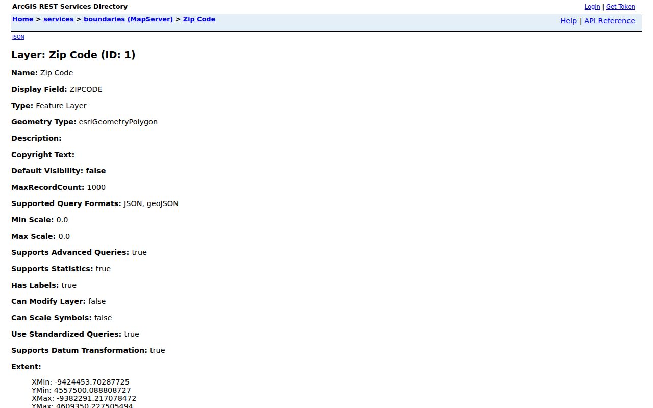
The visible schema makes the map reproducible. It does not identify a household or confirm postal delivery to one person.
Lexington ZIP Stations by Name
Official USPS location entries give practical address-level checks. The main Lexington Post Office is at 1088 Nandino Boulevard, ZIP 40511, with phone 859-231-6700. Other identified stations include Post Rider at 210 East High Street in 40507, Liberty Road at 2041 Creative Drive Suite 100 in 40505, Gardenside at 1729 Alexandria Drive in 40504, and Brentwood at 1045 Brentwood Court in 40511. Current hours and services should be checked in the live locator.
A 2015 USPS release grouped Brentwood with 40511, 40507, and 40508; Beaumont with 40503, 40513, and 40514; Bluegrass with 40502, 40515, and 40517; Gardenside with 40504 and 40510; and Liberty with 40505, 40509, and 40516. A 2022 release again named several of these facilities. Those releases capture operations at a date. They do not enact boundaries or define Lexington neighborhoods.
Insider tip. Use station names for orientation, then verify the full street address with USPS before relying on an old ZIP label.
Search Lexington Mailing ZIP Codes
The USPS ZIP Code Lookup offers a city-and-state route and a full-address route. City/state search requires those two values. Address search asks for a street address, city, and state, with optional company, apartment or suite, urbanization code, and ZIP. Results can display in groups of 10, 20, or 30.
| USPS Field | Required | Use |
|---|---|---|
| Company | No | Business delivery name |
| Street Address | Yes | Delivery line to standardize |
| Apt/Suite/Other | No | Secondary unit |
| City and State | Yes | Postal city and state |
| Urbanization and ZIP | No | Extra routing details when known |
The result standardizes delivery data and returns the postal code. It does not confirm that a person or company is present. That common myth matters when searching residents ZIP code by ZIP code. A correct delivery line can still lead to an owner, renter, mailing contact, business, vacant parcel, or no publicly named occupant.
Find Lexington Residents by ZIP
ZIP is best used as a first cut. The GIS layer draws the area, MapIt resolves one address to civic layers, and parcel records provide ownership or assessment context. Voter-file access has separate statutory limits. No unrestricted official list of every resident within a Lexington code was located.
- Verify the address or city/state combination in the USPS tool. Keep the standardized street, unit, city, and ZIP.
- Query the LFUCG boundary service by ZIPCODE. Map the polygon and note that it may omit unique or PO-box codes.
- Use MapIt or parcel GIS for a known address. Compare parcel number, situs address, and mailing address without treating them as the same field.
- Use the PVA or deed custodian for property facts. A ZIP-wide parcel set describes land records, not all residents.
- For voter data, use the individual VIC lookup or the qualified SBE-84 route. Do not treat registration as current occupancy.
Once the area narrows to an actual road, the Lexington street directory explains the address-level chain. It avoids making a ZIP-wide search do work better suited to parcels, deeds, and street records.
Lexington ZIPs Versus City Limits
USPS codes describe delivery geography. They can cross municipal and county lines, and the postal city label “Lexington” is not proof that a parcel lies inside a city boundary. The consolidated Lexington-Fayette government adds another layer: a single address can carry a postal code, parcel jurisdiction, voting precinct, council district, watershed, neighborhood association, and historic district at once.
A mailing ZIP can differ from the situs ZIP stored for the property. Situs means the physical location used by the parcel system. A PVA mailing address can point elsewhere. Unique codes and PO boxes may not appear in GIS. Historic documents may retain an older ZIP or street name. Use E911 address history and current postal lookup before normalizing an old record.
- ZIP and ZIP+4
- A ZIP is a five-digit delivery area; ZIP+4 adds four digits for a smaller delivery segment.
- PO-box ZIP
- A code used mainly for post-office boxes rather than a mapped residential area.
- Unique ZIP
- A code assigned for a large organization or special mail use.
- Carrier route
- A postal delivery path within one or more ZIP areas, not a civic boundary.
Lexington Unique ZIP Code Cautions
The Kentucky.gov local list extends far beyond the fourteen polygons. It includes 40506, 40512, 40522, 40523, 40524, 40526, 40533, 40536, 40544, 40546, 40550, 40555, 40574 through 40583, 40588, 40591, and 40598. Older postal material groups some under other Lexington labels. The source also exposed a typo-like “4055” fragment, which must not be treated as a valid five-digit ZIP.
Neither 40501 nor 40518 appeared in the official current sources used for the research. They should not be inserted merely because an outside list shows them. Likewise, the exact present use of each listed unique code cannot be inferred from its number. Enter the complete address in USPS or ask the named post office.
Does every official Lexington mailing code cover streets? No. Some codes may serve boxes, institutions, or special mail operations. The GIS polygon list and postal list answer different questions, so a mismatch is expected rather than a database error.
Old Lexington ZIP Labels
No official current Lexington ZIP split or realignment history was found. Dated USPS station releases and archived Domestic Mail Manual lists are operational evidence, not proof that a boundary moved in a given year. When an old code fails, search the old street number and name in city directories, maps, and the library, then check E911 address changes and the current USPS result.
Lexington’s 1942 street directory and map can bridge a former address to modern GIS. Sanborn maps add building footprints and historical land use, while deeds and plats preserve legal descriptions that do not depend on a postal code. A ZIP code directory therefore works best at the modern end of a longer address trail.
Population figures also need care. The 2020 Census counted 322,570 Lexington-Fayette residents, and the July 1, 2025 estimate was 329,751. Those totals describe the consolidated place. They are not counts of searchable people in each postal area, and they should never be divided among ZIP polygons without an official geographic crosswalk.